
The New Zealand Tech Alliance is a group of independent technology associations from across New Zealand that work together to ensure a strong voice for technology.
Visit Tech Alliance


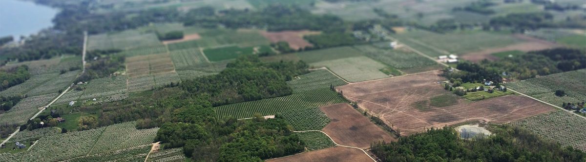


Elevation Aotearoa
Earlier in the month the LocationTech committee met with representatives from Toitū Te Whenua LINZ. The focus was to hear more about Elevation Aotearoa – a partnership between LINZ and Regional Council’s to procure and then share a nationally consistent elevation dataset for all of New Zealand. Based on current plans it is expected that 80% of the country will be covered by 2024.
As many in the Location Technology industry know, LiDAR (light detection and ranging) is a technology in which aircraft or drone mounted sensors capture a 3D view of the land as they fly over it. This generates a highly accurate point cloud which when processed creates sub meter accurate digital terrain models as well as digital elevation models that can be used for a wide variety of uses.
Currently data is already accessible for Auckland, Wellington and Christchurch, and by the end of 2021 Northland, Gisborne, Marlborough North and Canterbury will also be available, followed closely by Hawkes Bay in early 2022.
It is difficult to estimate how important national lidar coverage will be in the future. Lidar has been used by some industries such as forestry for many years but coverage has been limited. National coverage will allow expansion to many more industries. Agriculture in particular will benefit from lidar by enabling more accurate and smarter farming, but so too will natural hazard management, civil engineering and archaeology.
Find out more about the project here and start thinking about how Lidar could be used in your industry and let us know your ideas.
Location Tech is the voice of location technology and spatial intelligence in New Zealand. Subscribe for our regular updates here.